Light from all kinds of lightning.
GLM detects total lightning, both in clouds and involving the ground. The type of an individual flash is unknown.
 Nephoscope
A closer look at the sky above us. Explore satellite lightning across the Americas, with the time and context behind every flash.
Coming to iPhone. Explore the recorded web preview now.
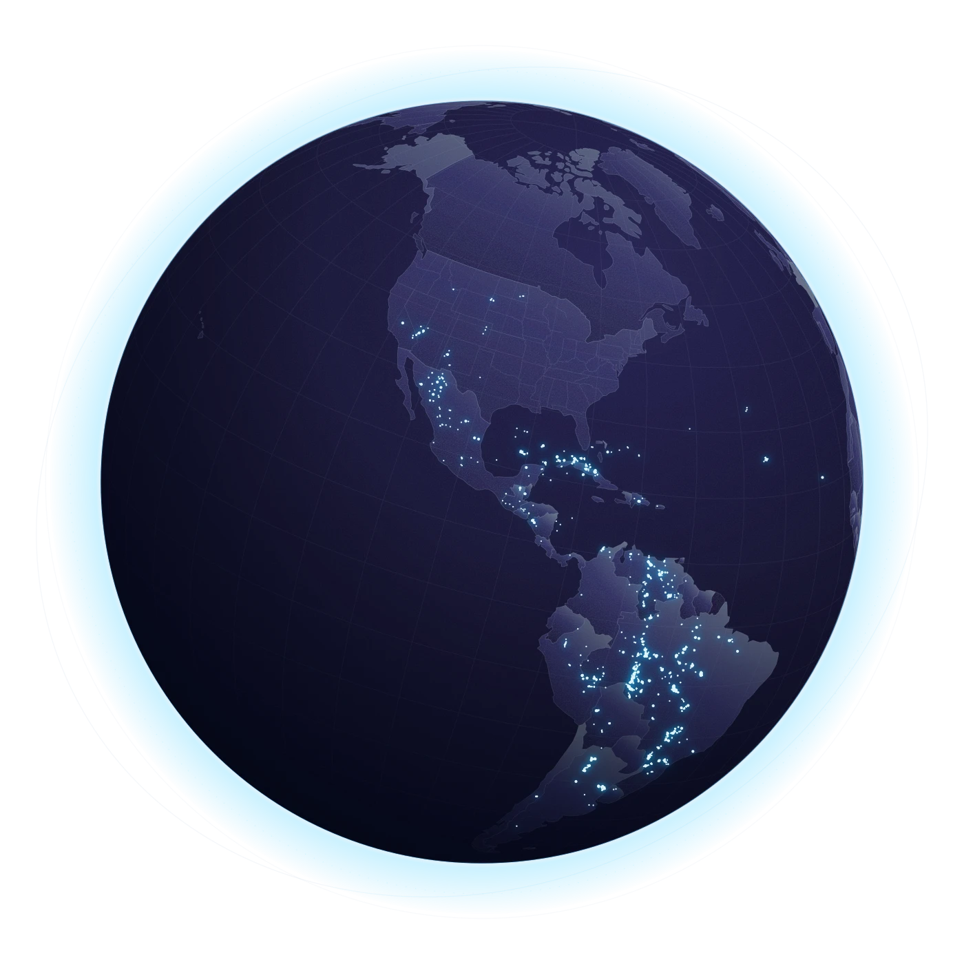
01 WHAT YOU’RE LOOKING AT
From orbit, NOAA’s Geostationary Lightning Mapper sees light from lightning. Nephoscope puts those observations on a map you can explore.
GLM detects total lightning, both in clouds and involving the ground. The type of an individual flash is unknown.
Each dot is an estimated optical center of a flash. It does not identify a ground strike or the full area a flash affects.
Fresh observations glow brighter. Older points fade through cyan to steel, so you can read their age at a glance.
02 THE SKY MAP
Start with the whole view. Search for a place. Follow a recorded day as the observations appear, then pause to see what happened.
Open the recorded map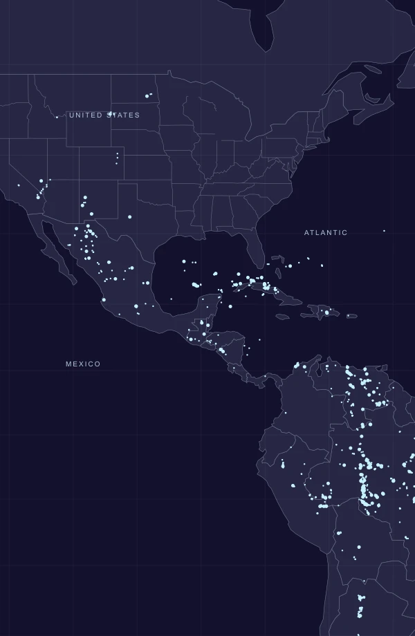
Recorded · Sep 28, 2026
NOAA GOES GLM · 21:00–21:10 UTC20-second samples, every 5 minutes
Browser preview · Recorded NOAA observations
iPhone app in development
03 A PLACE IN THE PICTURE
A pin gives the observations a point of reference. Rings show approximate distances to flash centers. They are advisory settings, not safety boundaries.
Advisory settings illustration
The outer ring puts nearby satellite observations in context.
Closer satellite activity carries seek-shelter guidance. Ground contact is still unknown.
A 30-minute quiet interval needs continuous usable data. It is never an all-clear or permission to go back outside. The sampled web replay cannot confirm one.
04 KNOW THE EDGES
GOES GLM sees the Americas and adjacent oceans. It does not cover the whole world, and being inside the field of view does not guarantee usable data.
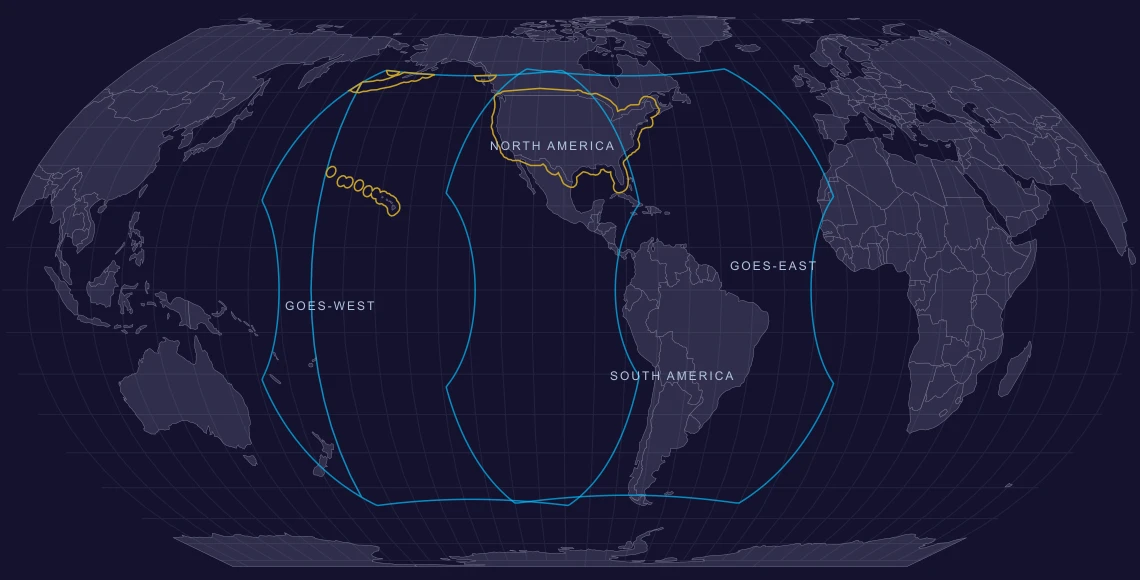
The planned base advisory region follows the 50 US states, with an approximately 150 km border and coastal buffer, clipped to GLM coverage. Some areas, including much of Alaska, are outside the field of view.
Missing data does not mean missing lightning. Check the source time and coverage status before interpreting the map.
FOR IPHONE · IN DEVELOPMENT
Nephoscope is coming to iPhone. In the meantime, spend a few minutes with the recorded sky.
Explore NephoscopeNotifications, on your terms. Push is the planned default. SMS is a separate, opt-in-only channel, still in development. Consent starts unchecked; reply STOP to opt out. Read the SMS terms